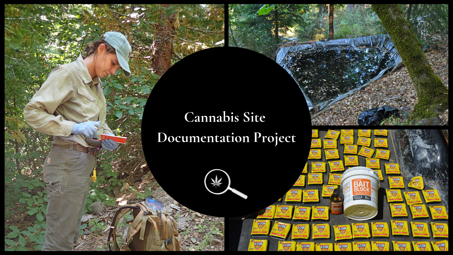
Each year, hundreds of new illicit cannabis cultivation sites are established illegally on public lands. Combined with several thousand historical sites that require remediation, there is an immediate need to document the distribution, type, and magnitude of environmental impacts to inform responsible policies and identify appropriate funding avenues. Since 2013, IERC has been a leader in developing safe and comprehensive data collection protocols for documenting environmental damage associated with cannabis cultivation sites. To date, IERC has assessed over 500 newly established and historic sites.
Objective: IERC is working closely with law enforcement agencies, public land managers and stakeholders across California and southern Oregon to visit and document the type and extent of grow site infrastructure, pesticides, fertilizers, water diversions, and other environmental impacts. Data collected through these efforts are utilized across a broad range of applications including identifying high priority sites for reclamation (see ‘Cannabis Reclamation and Restoration Project’), informing local and wildlife and watershed management plans, and generating regional ecological risk maps (see ‘Cannabis and Predictive Modeling Project’).